Unstable MW radio links

Al Salihi

New member
Dear All,

I have cases of unstable link?s performance due the RSL variation (up/down) is severe and higher than fade margin

link RSL varaite from normal 39 to -80 threshold during unstabilty time and has impacted performance DEM fail,RX fail,BER alarms


Problem:

Outage of MW radio links due to suddenly weather change


Expected reason:

There is a season when microwave fails in Egypt is in February and between April to October 2009 special July/Aug


Suggest proposal:

As I know applying antenna inclination if no
Deploying Space diversity as last resort


Would someone please advise on how normally we could controlled those instability links ?
 
Those links have following parameters design:

Annual Availability (%) is 99.999
Composite Fade Margin (dBm) is 34
Length (km) is aroud 10 km
Main Freq. Band is 25GHz_28MHz
Link Capacity : some are 75 E1 and some are 16 E1
Modulation :32 QAM or 16 QAM
Vendor : Alcatel MXC or AWY Alcatel

Please advise on how can control the unstable phenomena?


Ahmed Rashied SaadAllah
 
What do you mean by Weather change? Is it Rain or some sort of Storm or what?
Is there any particular time of the day or week during which this variation in RSL occurs?
What minimum value of "K" has been used to plan the link?
Do you have 100% of First and 60% of 2nd Fresnel Zone?

BR
Imran Sabir
 
Thanks for prompt response

Weather change from cold climate to hot climate suddenly and back later from hot to cold
Time is night and some in day
Fresnel Zone is clearance with 100%
Min K has used as appear in pathloss for 2nd Fresnel zone


Awating your feedback , Thanks a lot
 
Abrupt changes in the weather actually cause the "k" value to change from one extreme to other( from Sub-refraction to super-refraction). This change is weather from hot to cold or vice versa causes the Ducting phenomena.
Plan the link with two different values of 'k". Normally it is recommended to use the chart defined by ITU for the K-zones for different regions. To be on the safe side plan the link for k=1.33 at 100% fresnel zone clearnace and K=0.67 at 60% of the fresnel clearnace. This will change your link's antennae heights.
If the problem still persist then you have to plan the link with SD configuration.
Lets give it a try.
 
Path problems.

Please put the coordinates or the profiles of the links on the fourm and let me take a look. If the links are around 10Km long it is VERY UNLIKELY that you are having a "proppagation" problem caused by multipath or obstruction fading. The paths are just too short to be affected by normal refractivity gradient changes. If the problem is not rain related I would suspect that you have one of these two problems. Not enough clearance on the links and a change in refractivity may cause an obstruction outage but if as you say you have 100%F1 @ K=4/3 then this will not be a problem. Are by any chance one of more of the antennas mounted on mono-pole structures? If this is the case you may have a problem with the antenna alignment.

Remember that in all but the most extreme cases multipath and obstruction outage on short hops 8-10Km or less is almost non-existant and to be ignored.

Let me know and post the coordinates or pl files and I will take a look for you.

Louis....
 
Agreed with you, I have attached the Pathloss design.PLW4 for your considering

RSL variation happened with 14 links in same time period it's been 3 days links are unstable RSL goes from normal RSL (planned) to threshold and back

Alignment of those 14 links is well
Most links path is around 10 Km and some are above/less check the attachments


Thanks for interesting and appreciated your prompt reply ?.
 

Attachments

  • Links Design.zip
    29.4 KB · Views: 36
Problem Links.

I looked at your design and I don't see anything bad, I did notice that one link had the tx pwr at 1.5 db on the el qussey east to giza link I imagine you did that for rfi reasons. All the links have very good fade margins and I looked up the local weather recently and there don't seem to be any heavy rain falls.

I did notice that the clearance is in fact as you say 1f1 at k=4/3 but keep in mind that at the frequencies you are using the .6F1 at k=4/10 may be a problem if you have sub-refractive or obstruction fading.

It all depends on how acurate your profile is. I see the data points in your profile are from a digital terrain db and that you have no buildings or vegetation along the paths. For example the Giza 12 to Mallawi link at the middle of the path you have exactly the clearance you need. Ie. there are several places where the clearance is 0 k is 6.4m anf F1 is 3.7m this means that a 10.1m error in the terrain data would block your path. With hi frequencies it does not take much to attenuate 20-30db.

How acurate is your terrain data? If its a ground survey with teodolite then it should be acurate. Also I don't have detailed maps of the area but as you can see in the map your links cross over the valley where there are trees and structures.

Having said all this it is very strange that all the links are having problems at the same time. Can you tell me at what time do the links have problems. In the morning, afternoon, evening, early evening, late nite or early morniing. Is there a sequence to the outages, like from north to south or east to west. Do the longer links go down first. Are the support structures mono-pole, towers or buildings. If the outages are random, have you recently done a software upgrade to the radios or your supervision network. Are the outages real or is the supervision going crazy.

Let me know and I will keep thinking about your situation. After you have answered these questions maybe I might be able to lead you in the right way.

Louis.....
 

Attachments

  • Map.jpg
    Map.jpg
    6.9 KB · Views: 35
How can you check the Local weathr is it from http://www.dxinfocentre.com/tropo_mid.html#hour12?

About antenna height in pathloss I put the min height but actually all antenna are setting above 25 m for physical LOS survey

Time of outage is during late night and takes 3 hours and then RSL variation under fade margin (unstable) until morning links up

As per civil work all tower, antenna are fixed well

I am checking about software upgrade to the radios and found nothing has been happen !
 
Thanks for advise ...

How can you check the Local weathr is it from http://www.dxinfocentre.com/tropo_mid.html#hour12?

About antenna height in pathloss I put the min height but actually all antenna are setting above 25 m for physical LOS survey

Time of outage is during late night and takes 3 hours and then RSL variation under fade margin (unstable) until morning links up

As per civil work all tower, antenna are fixed well

I am checking about software upgrade to the radios and found nothing has been happen !
 
Problems Paths.

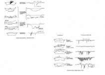
Take a look at the document I included but based and what you are telling me about the outage time and durration it seams that you are experiencing obstruction fading. The example is the second one on page one.

Do this, input the real centerline in in link files. Then go to the terrain data and input a tree and/or building at the controlling points. Use the typical height of the buildings and or trees you would find in the area you are crossing. For example if the path crosses over a banana plantation the add 7 meter trees at the controlling points. If the path crosses over an olive grove add 5 meter trees. If the path crosses over eucalyptus trees then add 30 meters, basically use typical height for typical trees in the areas. Then calculate the clearance and the obstruction fading. If the path crosses over a rice paddy then assume that you will have a layer of water on the ground and look for out of phase reflection points that are visible to both antennas.

Always do a path design with man-made structures, vegetation and cultivation along the links and look for potential problems. Then calculate the impact of the potential problem. If you can calculate a problem then you go out in the field and verify if your asumptions are really there. Let me tell you that along the valley you will find, trees, water from irigation and buildings.

As far as the weather goes the link you provided if for HF and VHF propagation, I don't know if this is applicable in your situation because the ducts they are talking about are high in the atmosphere, keep in mind that your links travel along the ground from 0 to 100 meters and what I said earlier is still true, the links are relatively short and not likely to suffer from ducting.

Let me know what you find and send me the link files with the real centerlines and where you think the trees/buildings are along the links and we can look at them again. Remember that you can see what is along the path by inserting the links in google like I did and then go along the paths and mark down where you cross large trees or buildings.

Let me know.

PS. I had to compress the file a lot to upload it. If you give me your e-mail I will send it directly.

Louie....
 

Attachments

  • fading.JPG
    fading.JPG
    13.6 KB · Views: 22
Last edited:
Seems you are v.experience engineer, appreciated your help and support

Man-made structures / vegetation/ tree Obstructing has been already taken in design as antenna height that on field is between 25 m and 40 m


One thing I can tell there is really irrigation on this agriculture lands that have rice paddy..etc need water as I heard yesterday from site engineers BUT that is usually NOT irrigation for specific period

You are true ducting phenomena is not in there since links are using hi Freq and short distance, check http://www.dxinfocentre.com/tropo_mid.html#hour12 for ducting forecast


This is my e-mail ahmed.rashied@yahoo.com


Keep in touch on on next step!
 
One thing I would like to know. How long are the links in service. Have you had the same type of weather before that you are having now. Has it affected the links before. has anything changed since the links went into service.

louie.....
 
How long are the links in service ? some are newly and some are due to 2004


Have you had the same type of weather before ? Yes but was in may NOT Feb

Has it affected the links before ? yes but not that as much as today


has anything changed since the links went into service ? no

As u said ,the problems affect all the paths at one time,I expect non-normal fading situation and want to know how can secure those links , should use SD or uptitle the antenna ?
 
Once again,
I did re plan link with kmin and Kmax and
I did generate path profile based on actual surveyors reports

But in same area -Upper Egypt I have same problems affect all the paths at one time,

I expect non-normal fading situation like what u said and then want to know how can secure those links, should use SD or uptitle the antenna?

Please it's serious problem want your advise

Those links are still unstable and RSL is dowm/up?
 
Imran Sabir urgent

Salaam Brother Imran ,

I am looking for your contact phone number ,location?

Me and Mr Abdul Durrani want to discuss opportunity with over phone ,he knows you well and am interesting to get know each other


Thanks
 
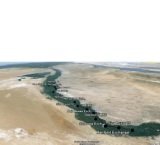
Hi Ali I took a look at one of your paths Abo Qurqas-Giza Luxor and have concern regarding using a such highe frequency with small antennas in a long path, also I plotted the path on Goggle Earth (which you may also use as a tool to help identify obstructions with an exact distance from point A or B) and notice a large flat and wet area which may act as mirrors creating reflection.

The higher the frequency the smaller the lambda which it will it make more vulnerable to rain or mist during the night. So one option is to use lower frequencies or as mentioned before SD configuration.

The modules of Reflection & Diffraction in Pathloss may be of great help by varying the frequency.
 
Yea I mentioned that in my post...

I dont know if that was to help me? Thanks,

But I guess I should clarify my post...

I was just suggesting for people to check their sigs, cause a lot of the links arent updated.

Just trying to help

-C
 
Back
Top